After a complete Irish breakfast at the hotel, we were ready to taxi off to the visitor center for the Cliffs of Moher. Portions of this trail have been closed to walkers, either because of trail erosion, or because too many visitors have taken chances and been hurt or killed.
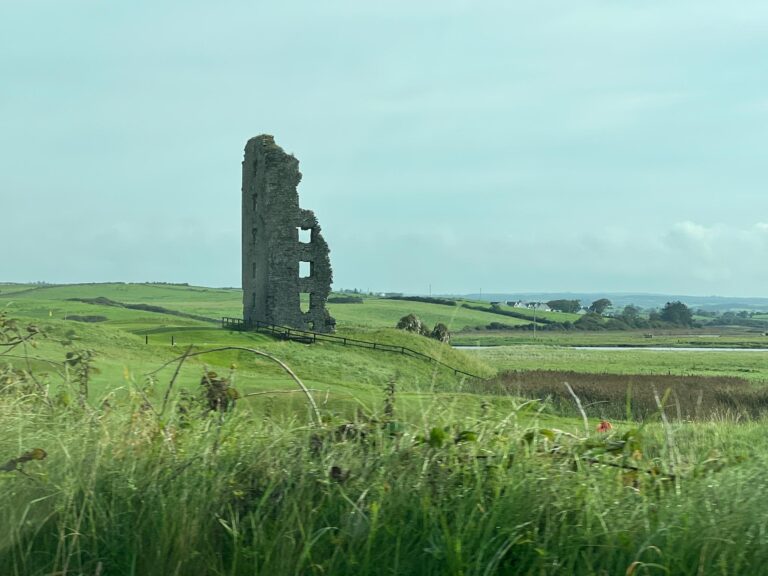
Liscannor is the next town closer to the cliffs, and we could see this tower from Lahinch. It would traditionally be the start of today’s walk.
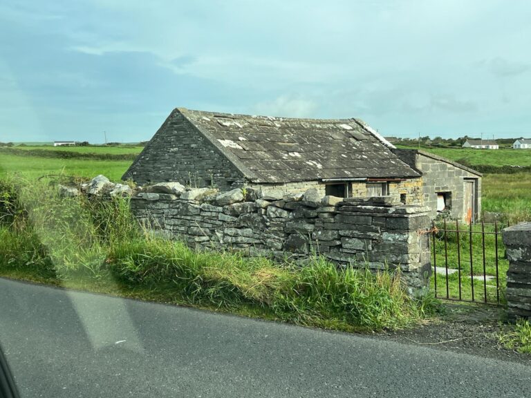
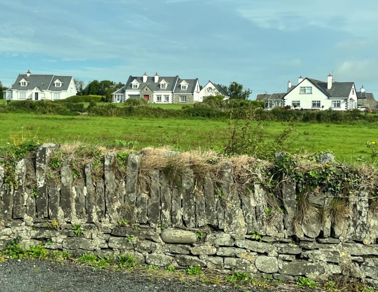
Our taxi driver, Denis, is interested in the economy of the area and kept a lively conversation going. He explained that the oldest homes had few windows and incorporated the flat stones of the area for building, even making stone roof tiles. These farm homes were usually inherited by the first son, but the farms did not produce enough to support more than one family, so other children had to leave for work. Denis himself had left for a job in high tech when his brother inherited the farm.
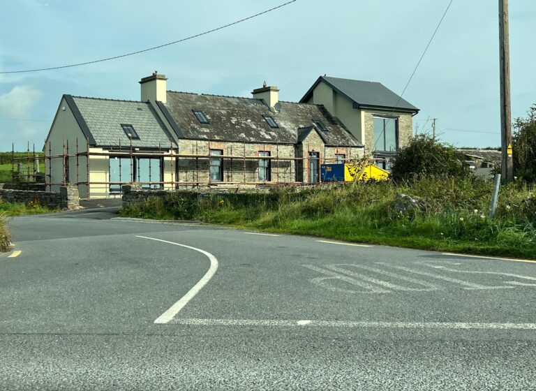
If an older home had two chimneys, the owner is allowed to expand on each side, usually with a modern kitchen and modern bathroom.
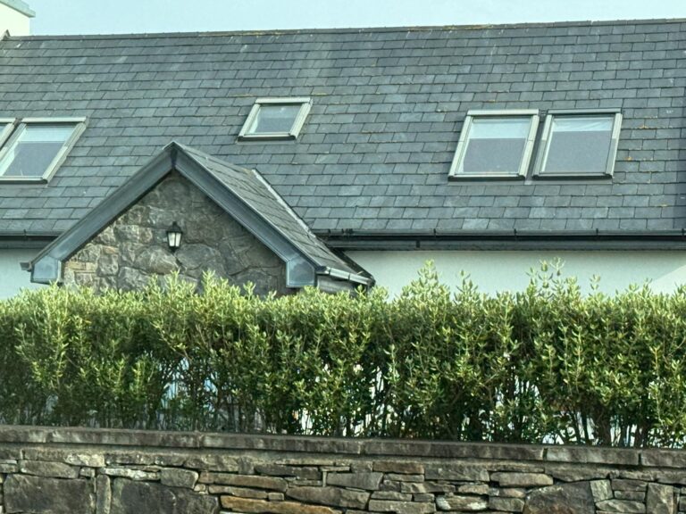
The newest homes have skylights.
New homes are being built in modern styles, but these are only allowed on the inland side of the highway; nothing directly on the coast. Now the challenge is to bring services out to these new developments.
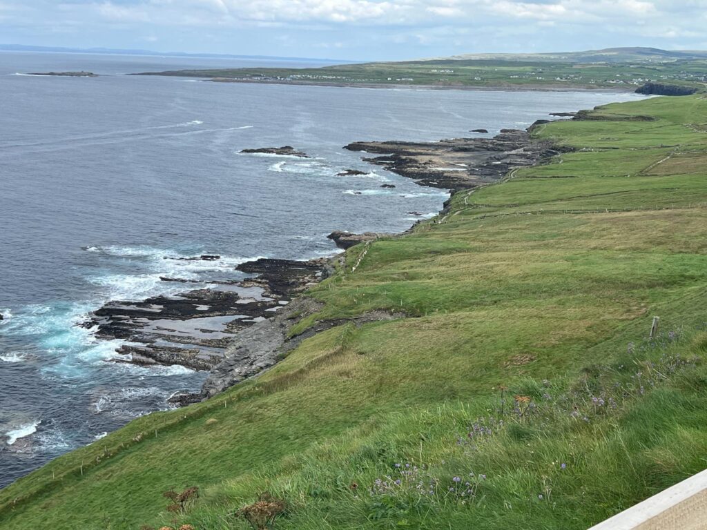
The flat stones of the area between Lahinch and Doolin are not only used for building, but they allow water to drain easily and stay warm enough year round so grass can stay green. After Doolin, the landscape will change.
Goodbye to Denis, our taxi driver and tour guide who left us at the visitor center.
Sunday crowds were enjoying the good weather. Besides the visitor centers and shops, we can go on paths both north and south of the visitor center to see the scenery. Motorized vehicles can carry mobility-impaired visitors.
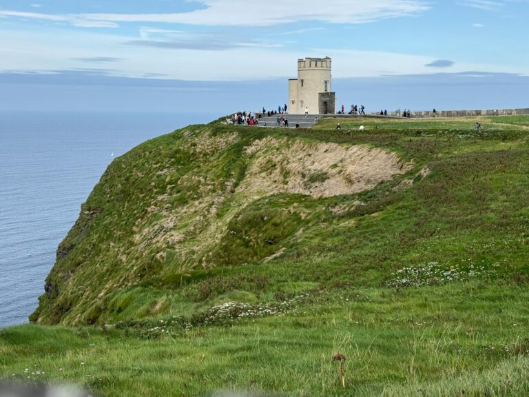
O’Brien’s Tower was built in 1835 by a descendant of the first High King of Ireland. He was ahead of his time in realizing the effect of tourism on the economy.
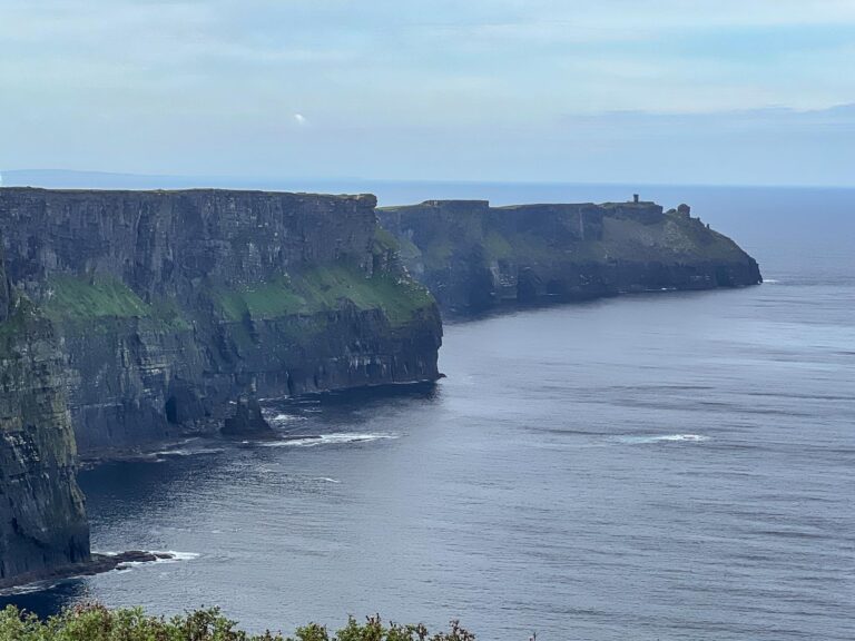
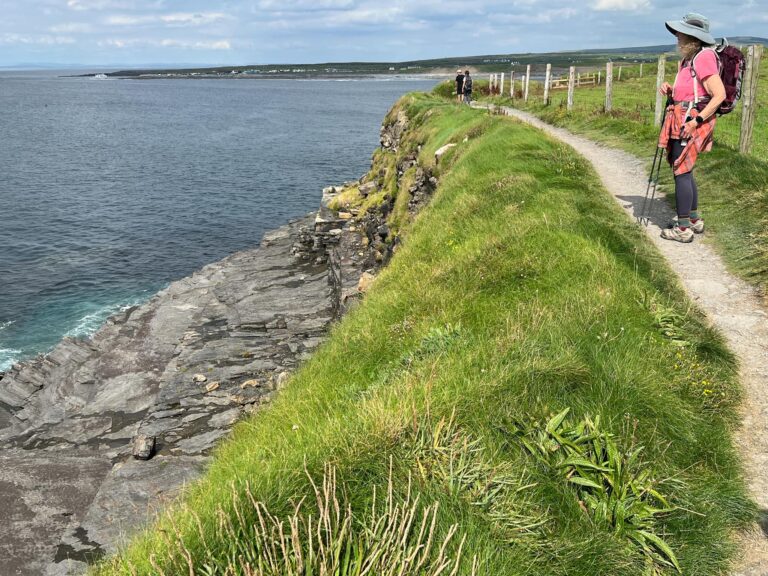
From the north side, there is a stunning cliff view all the way to Hag’s Head.
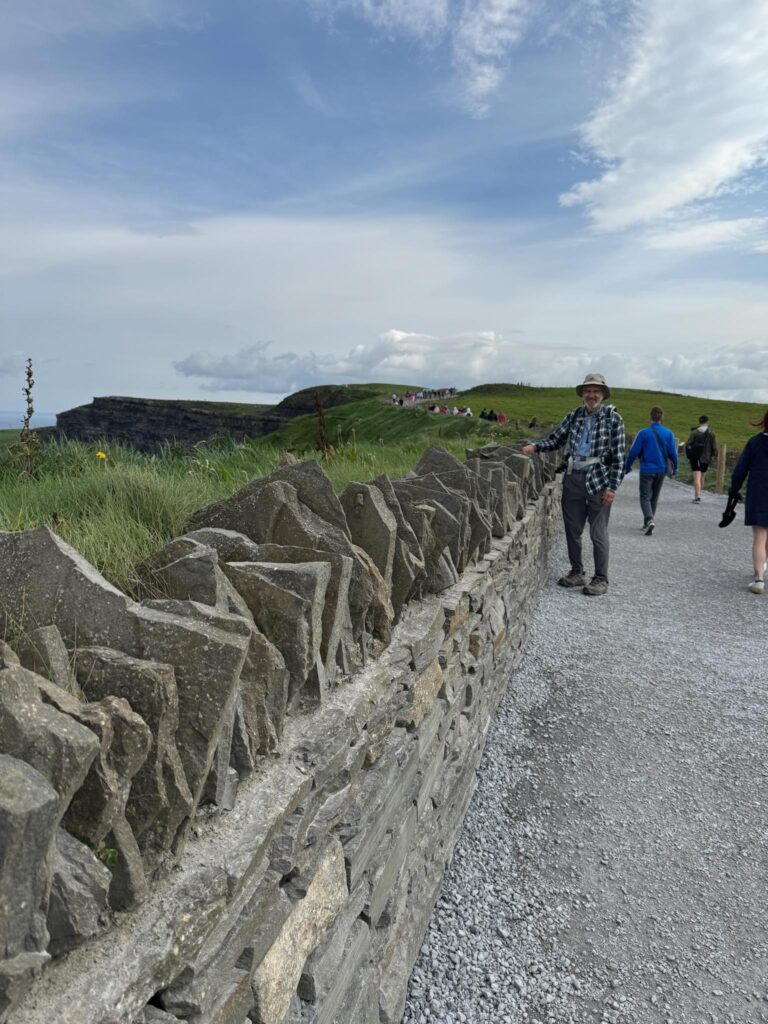
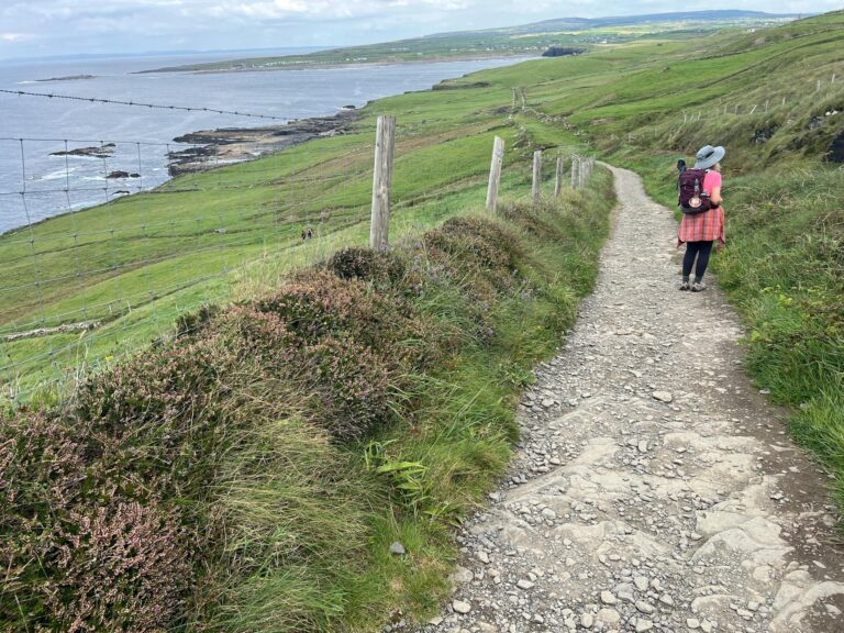
Walls built from the local flat stones line the cliff side of the public trails. Note also that stones are piled vertically on top to try to dissuade visitors from going over the walls.
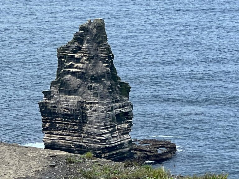
The haystack, one of the favorite places to see nesting birds.
When we began today’s hike, we had to walk about a mile on the road with cars, buses, motorcycles, and camper vans. You can see that there is very little clearance, but Sunday traffic at least slowed the pace.
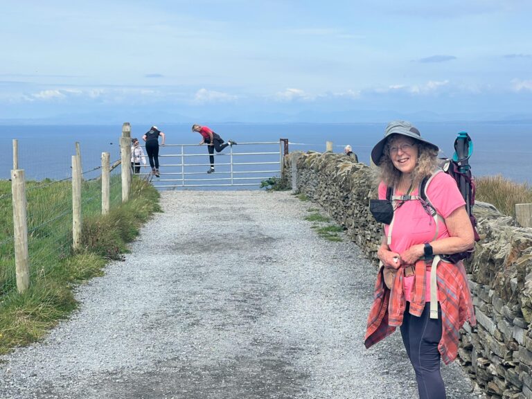
Despite signs alerting to the walking path closure, and a physical barrier coming from the visitor centers, people were still climbing around to the path. Here they have reached the end and must climb over the wall.
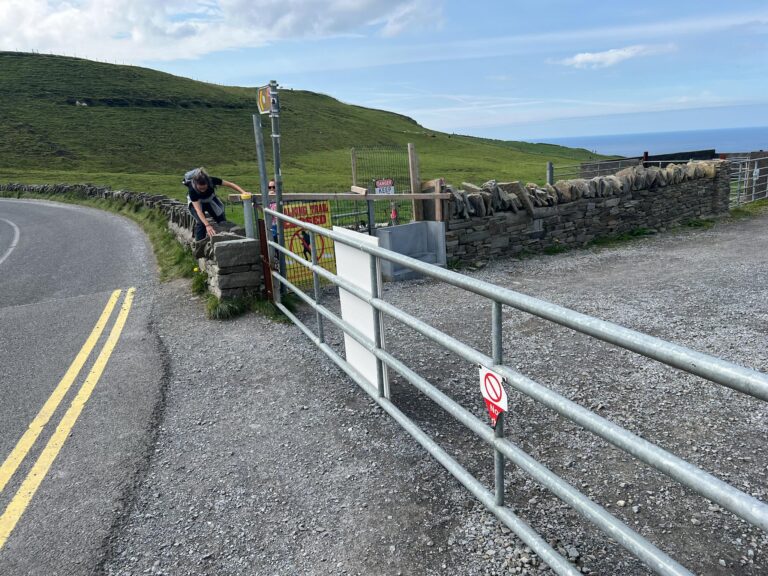
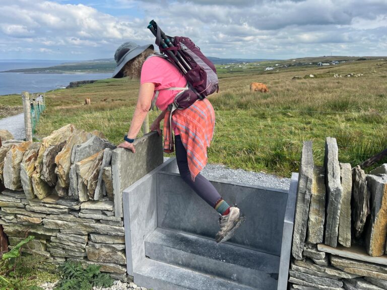
Denis, our taxi driver, had showed us the gate where we needed to start, and told us to open the gate if it was closed. Unfortunately, it was locked so now we too had to climb through the gate.
More walkers climbing over the gate from the closed walking trail. Fortunately our trail took off just before the gate.
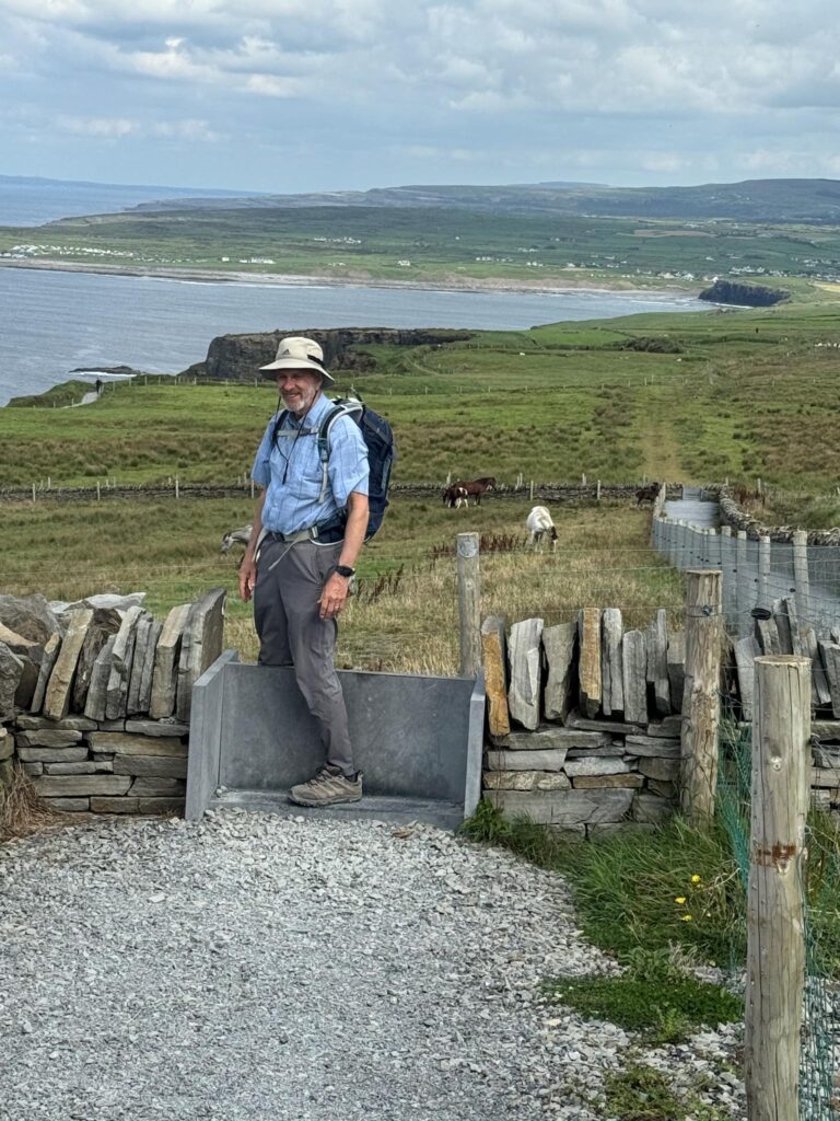
There were many different stiles on today’s walk These modern metal ones sometimes had extra steps and sometimes were a simple vertical grade to manage the animals.
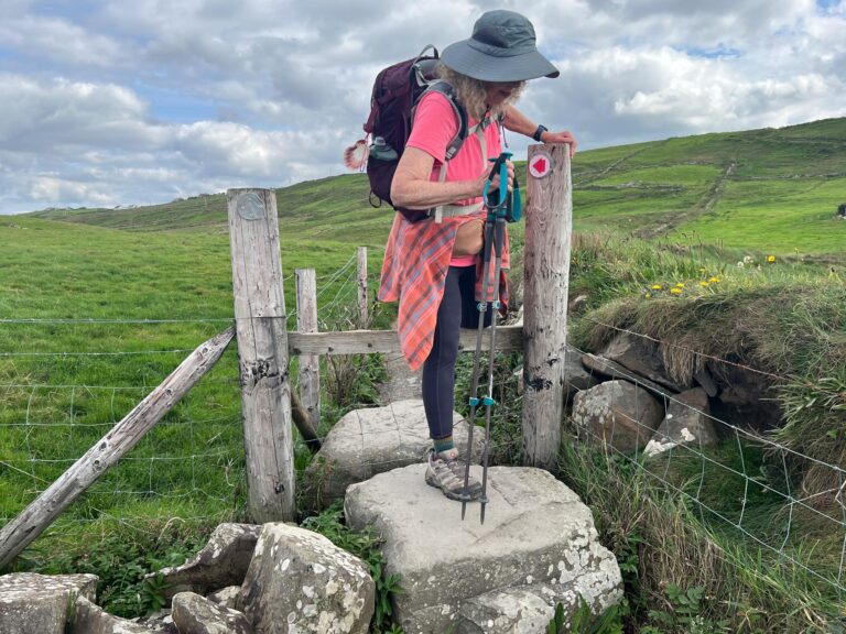
This stile blends with fence posts, and uses rocks as stepping stones.
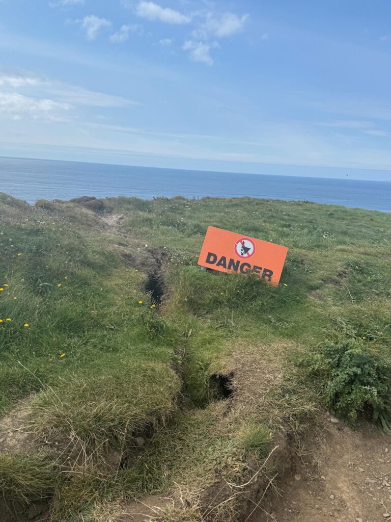
There were other techniques tried to keep visitors on the appropriate trail. You didn’t have to tell me twice when I saw this Danger sign on the cliffside of the trail, especially seeing the eroding crack.
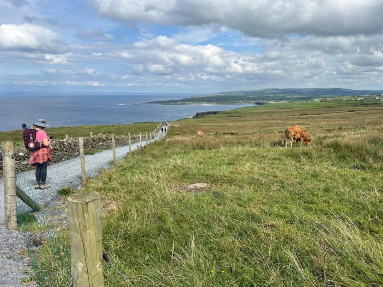
Grazing land was usually separated from the trail by electrified fences with caution signs. However, we saw donkeys rubbing their backsides against the rock fences and touching the wires, so we began to doubt how well the electric fence was working.
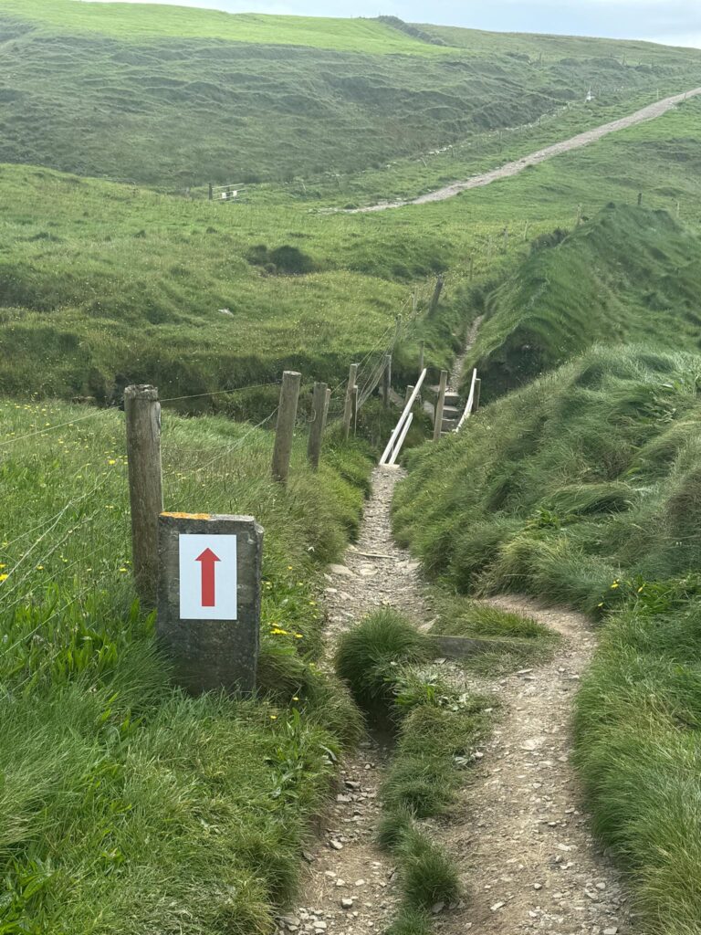
Sometimes it was a bit difficult to determine the trail. Marker signs made it clearer.
The trail has been gradually dropping from the elevation at the cliffs to closer to sea level. The path has gotten rockier, but the scenery is beautiful.
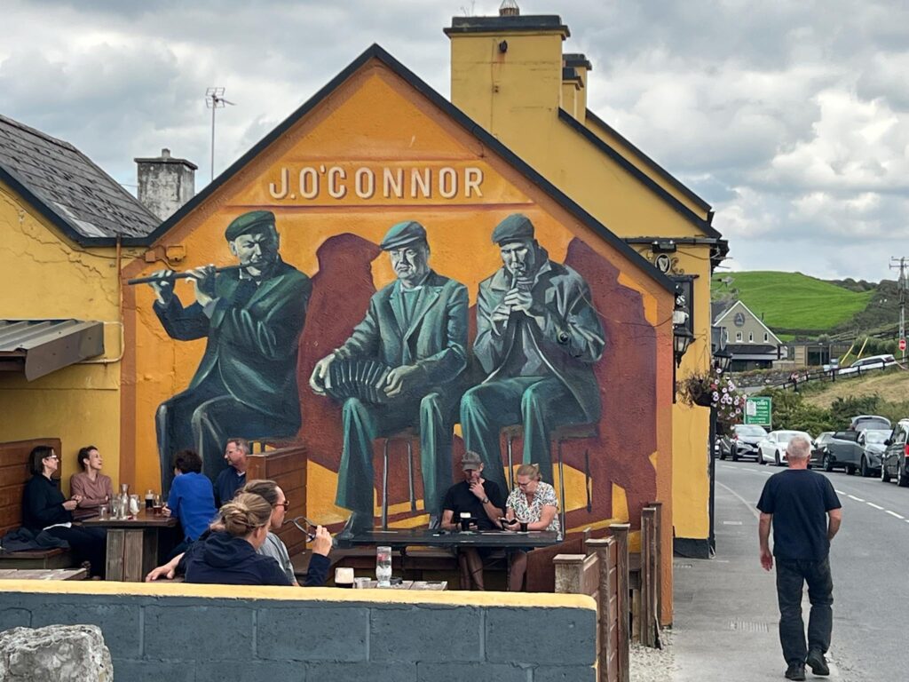
Finslly we reach Doolin’s Fisherstreet and pass Gus O’Conner’s Pub where we later ate dinner,
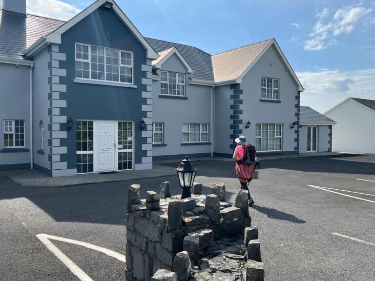
Our hotel for the evening, the Atlantic View, was a bit further down the road, but closer to the ferry terminal.
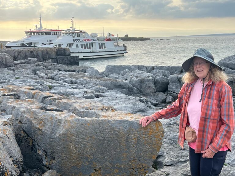
We checked on the ferries for our 9 am ride to Inishmore tomorrow. Looks good, but we have been warned about a storm approaching.
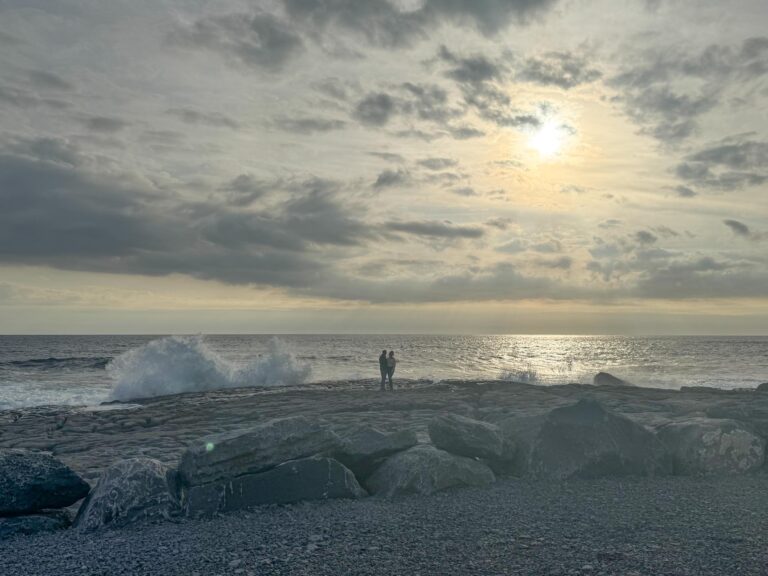
Tonight’s sunset does look different with more clouds and an eerie glow. Just look at that surf!


8 Responses
Beautiful scenery, but scary trail. Walking the roads would certainly scare us! Keep safe!
Like Denis, our taxi driver, said “It’ll scare you but it won’t kill you.” We took his word for it. There’s no way I’d walk on a closed trail—I’m never quite sure why it’s closed.
Well, I have finally caught up with you. The place where you stay two nights ago, said there was a lot of snoring which they assumed was Richard. but they said you tipped well so they forgave you. They were still counting the coins when I checked in. They were curious about the little brown ones from the U.S. I just smiled …as I am sure Richard did as Jan stood there shaking her head. I did assure them the guy on the coin was a pretty famous man, in spite of the beard. Obviously a kin of Richard. I’ll let others talk about the dynamics of the church. Great workday though I was not able to participate. Carry on, but be careful about climbing over fences. I thought at first the photo was of one of the two of you. Enough for now. Dave
Richard has categorically denied that he snores (ha!) Also, he notes that he is a big tipper, often with nickels rather than the copper coins.
That seemed like a not so normal walking adventure this day. Wendy and I also loved the views of the cliffs that you see from the visitors center. We walked a couple of miles on the main trail from the visitor center under the cliffs but that must have been closed to you? The great part of your daily adventures is the wrap up meal that always seems delicious. Your adventure is much more than the daily walks. Dan
I’m not sure why this was not a normal walking day, other than the transport at the beginning. There were several parts of the trail that were closed, but there was still lots of beautiful walking. Of course, there is great nourishment at the end of every day.
What beautiful scenery! Congratulations on all your wonderful research Jan! You found some incredible places to walk although the narrow road did look a bit scary! I agree with you about the great nourishment. Looks so yummy! Wendy
The research is done by our travel company now as we are on about a week-long hike. They’ve done a great job!